
Free editable map of France for PowerPoint presentations. Large resolution outline map templates. PPTX document with 5 professionally designed and ready-to-use slides.
The PowerPoint map of France is fully editable. That means these are vector-based maps in PowerPoint format. Colors (fill and line), size or even shape effect can easily be changed or added to perfectly fit your presentation template (if needed).
Finely detailed outlines: if you enlarge the map you will get a large and sharp level of resolution (coastlines and borders).

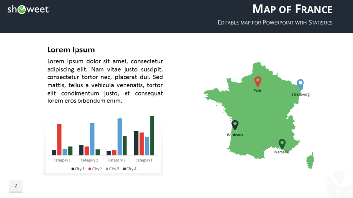
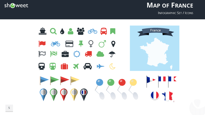
This free map template of France includes a set of infographic elements with practical icons and pins to effectively illustrate your map.
2 size layouts are available for your convenience: standard (4:3 screen ratio) and widescreen (16:9).
The ‘Map of France Templates for PowerPoint’ features:
- 5 pre-designed unique, clean and professional slides
- Fully editable content (graphics and text) via PowerPoint – No Photoshop needed!
- All maps are 100% vector. Easy to customize style (e.g., fills, outline, effects and scale) without quality loss
- Modern, attractive and professional colors
- Aspect ratios: Standard (4:3), Widescreen (16:9)
- Format: PowerPoint (.PPTX)
- License: Free – Attribution (please read carefully the ‘Terms of Use‘ before using this template, restrictions may apply)
Free font used:
- Calibri (System font)
Slides included:


Google Slides preview:
(Direct download from Google Slides is deactivated. To use this template with Google Slides, first download the .PPTX theme on your desktop, and then import it in Google Slides – read the tutorial)


Comments are closed.