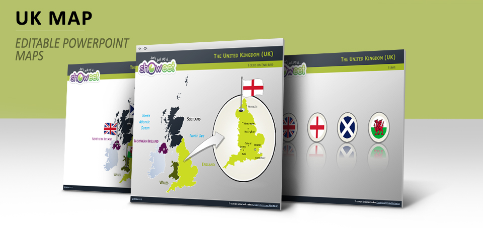
Editable maps of the United Kingdom with outline countries (England, Scotland, Wales and Northern Ireland) for your PowerPoint presentations.
Editable = you can easily edit each country (or the United Kingdom outline) to add your color, special effects or resize to fit your Powerpoint presentation.
Bonus: 3 slides with flags of the United Kingdom, England, Scotland, and Wales (Northern Ireland being the same than UK), with different shapes/effects
United Kingdom or United Kingdom of Great Britain and Northern Ireland. Commonly called Great Britain or Britain. Abbr. UK
A country of western Europe comprising England, Scotland, Wales, and Northern Ireland. Beginning with the kingdom of England, it was created by three acts of union: with Wales (1536), Scotland (1707), and Ireland (1800). At the height of its power in the 19th century it ruled an empire that spanned the globe. London is the capital and the largest city. The population of the United Kingdom was estimated to be 61.4 million in 2008.
Source: thefreedictionary.com
Presentation Package includes:
- 15 slides with editable vector maps
- Premium-quality customizable maps (can be resized or colored)
- Main cities
- Formats available: PowerPoint 2007-2013 (.PPTX)
- Licence: Attribution-NoDerivs 3.0 Unported (CC BY-ND 3.0)
Slides included:


Comments are closed.